
 |
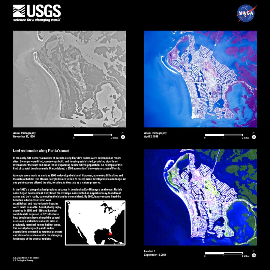
| Land Reclamation Along Florida’s Coast. Credit: USGS, Landsat 5 |
The Landsat project is a joint effort between NASA and the U.S. Geological Survey (USGS) and provides satellite imagery from 438 miles above the Earth’s surface.
The resulting information has been used in numerous scientific and operational studies in a variety of fields: from ecological studies, to agricultural monitoring, and land management decisions.
During the last three decades, Landsat 5 has documented many historical events such as the Chernobyl nuclear disaster, and more recently, the Asian tsunami of 2004.
Now that USGS has officially decommissioned Landsat 5, it has been maneuvered into a lower disposal orbit, completely shut down, and its transmitter turned off.
The end of Landsat 5’s transmissions, however, does not mean an end to the Landsat project. Landsat 8, the latest of USGS and NASA’s remote sensing systems, was launched in February. It will orbit the Earth once every 99 minutes, offering data to researchers every eight days.
Those interested in seeing some of the images from the different Landsat programs, learning about upcoming missions, or offering a tribute story about Landsat 5 can visit the USGS Landsat website.
Aucun commentaire:
Enregistrer un commentaire